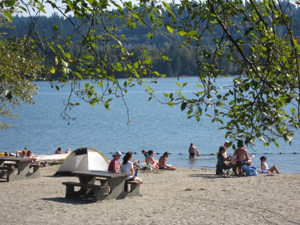
Rocky Point Park, Port Moody
Port Moody
Port Moody is located on the waters known as Burrard Inlet in the Metro Vancouver area of Vancouver, Coast & Mountains. In fact, this is as far east as the Inlet goes as it flows in from the Salish Sea beyond the city of Vancouver. The tidal waters provide opportunities to see wildlife including sea lions, seals, ducks, herons and many other birds. The area around this Inlet is called Rocky Point Park. A walking and biking trail surround the waters dipping through forests, crossing the water on a narrow boardwalk, offering a place to spot spawning salmon at the right time of year, and stopping at a sandy swimming beach. A wooden pier with hanging flower baskets and seating attracts those who want to watch the pleasure boats launching and kayakers go off on excursions.

Orchard Park, Port Moody
Port Moody is a growing community but one that has kept its charm. Newport Village, opposite city hall, has a collection of boutiques and unique shops as well as eateries, delicious ice cream and more. The old town has kept much of its historical feel with shops and dining adventures plus there are several small craft breweries close by. And there are art galleries and studios located throughout the community.
Belcarra Regional Park is nearby and brings locals and visitors alike to enjoy its beaches, trails, and a unique floating walkway around Sasamat Lake. The wharf is ideal for crabbing, fishing, and scuba diving.
Location
Port Moody is within an area known as the Tri-Cities which incorporates Coquitlam, Port Coquitlam and Port Moody. It is bordered by Coquitlam on the east and south, and Burnaby on the west. The villages of Belcarra and Anmore, along with the rugged coast mountains, lie to the northwest and north respectively. Both downtown Vancouver and the US border are approximately a 40 minute drive by car. To access Port Moody use Hwy 1, Hwy 7 or Hwy 7A.
Step Back in Time
The early inhabitants of this area were the Squamish and Musqueam bands of the Coast Salish people, their ancestors having occupied the Lower Mainland for the past 8,000 years. They used the Port Moody area to fish, hunt, and gather shellfish. Evidence of their summer campsites, in the form of shell middens and Indian artifacts, can be found at the eastern end of Burrard Inlet.
Non-indigenous people began to occupy the area around 1800. Fur traders regularly traveled through this region. With the appearance of gold prospectors during the Cariboo Gold Rush of 1858 and the need to develop a back-door defence for New Westminster, in 1859 the Royal Engineers were sent to clear a trail. The trail, later known as North Road, would allow ships anchored in Burrard Inlet to unload military supplies and personnel if New Westminster were attacked from the south. No attack occurred, but a town – at first no more than a cluster of tents and shacks – began to grow.
Big changes came in 1886, when Port Moody was named the original Pacific terminus of the transcontinental railroad (later extended to Vancouver). The town experienced an influx of new residents and the combination of railroad and harbour proved ideal for many light and heavy industries. Port Moody was incorporated as a city in 1913.
Port Moody and Nearby Accommodations
British Columbia Lodging and Campgrounds Association Members
List
Map


