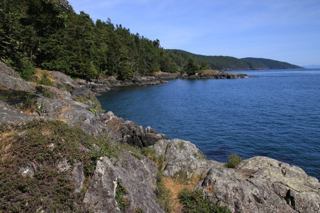
Beaver Lake Resort Trail - Lake Cowichan, BC. Photo Courtesy of the Beaver Lake Resort
- Coast Mountain Circle Tour
- Discovery Coast Circle Tour
- Fraser Country Circle Tour
- Gold Rush Trail
- Hot Springs and Heritage Circle Tour
- Kettle Valley Railway Tour
- Northern British Columbia Circle Tour
- Pacific Marine Circle Tour
- Peace River Country Circle Tour
- Sunshine Coast Tour
- Totem Circle Tour
- Valley Vineyards Circle Tour
- Okanagan Lakes & Rivers Circle Tour
Pacific Marine Circle Tour
The Pacific Marine Circle Tour is a short 290 km (170 mi) journey along Vancouver Island’s coasts, and offers beautiful views of the Juan De Fuca, Haro, and Georgia straights. The quiet ambience of the island relaxes visitors with views of quiet parks and ocean-side towns. This short tour is best experienced over 2 to 4 days and will make you fall in love with southern Vancouver Island.
Route Directions
- In Victoria, begin your journey by heading north on the Trans-Canada Highway 1 and then travelling west along Highway 14 to the community of Sooke (40 km/25 mi).
- Continue on Highway 14 up the western coast of Vancouver Island to Port Renfrew (71 km/44 mi).
- From Port Renfrew turn inland and northeast to Lake Cowichan (62 km/39 mi).
- Follow Highway 18 to Duncan (29 km/18mi).
- Head south on Highway 1 to Cobble Hill(14.5 km/9 mi) and Mill Bay (7.5 km/5 mi).
- From here, you can complete the circle tour by driving south on the Trans-Canada Highway 1 through Malahat (15 km/9 mi), and then on to Victoria (48 km/30 mi).
- An alternate route is via a BC Ferry from Mill Bay to Brentwood Bay (25 mins), and then driving south on Trans-Canada Highway 17 to Victoria (22.5 km/14 mi).

Tour Experiences
Victoria to Sooke
Begin your journey in British Columbia’s capital, Victoria. With a stronghold of British traditions, Victoria’s double-decker buses, horse-drawn carriages, meticulously kept gardens, and the tradition of formal afternoon tea has contributed to the city’s long-standing reputation of being a bit of Britain on British Columbia’s west coast.
Victoria, the capital city of British Columbia, was originally established in 1843 by James Douglas as a fort for the Hudson’s Bay Company. Bastion Square marks the site where a portion of the fort once stood, although all that remains now are two iron rings set into the rocks at the foot of Fort Street, next to the old Customs House. Today, Victoria has become a destination for outdoor adventurers. With a mild climate well suited for kayaking, cycling, hiking, fishing, golfing, windsurfing, and diving; outdoors enthusiasts here are active year round. Victoria’s Inner Harbour is always bustling with kayaks, whale watching boats, ferries and float planes. The city is also steeped in rich history that is put on show throughout the many museums, heritage buildings, and China town. Explore native totems and artwork in the local parks, tour the legislative buildings and don’t forget to walk through the extravagant Empress Hotel and the equally enchanting Buchart Gardens.
From Victoria, drive north along the Trans-Canada Highway 1 and then head west on Highway 14. Just 40 km (25 mi) away is the pleasant harbour-side community of Sooke. The first stop to make here is the Sooke Region Museum that depicts the local pioneer history with a film presentation, informative exhibits, and delightful Moss Cottage. To celebrate Sooke’s maritime heritage and its scenic beaches, a historic lighthouse monument complete with a rotating first-order Fresnel lens was opened in 2005 and offers visitors a unique viewing experience. The Sooke Region Visitor Info Centre is located at the museum and is the place to find out more about activities like fishing, golfing, kayaking, hiking, and whale watching. While you’re there, ask about annual events, including the Bluegrass Festival in June and the Sooke River Music Festival in mid-August. Sooke Fine Arts takes place over a two-week period in late June/early August and is the largest juried art show on Vancouver Island. This is an excellent opportunity to see some of the best work by the most renowned artists on Vancouver Island. Restaurants, art galleries, shops, and friendly people are abundant in Sooke.

Sooke to Lake Cowichan
From Sooke drive northwest 71 km (44 mi) on Highway 14 until you reach the town of Port Renfrew. Along the way, you’ll see spectacular views of Vancouver Island’s jagged coastline and witness awe-inspiring views of the surrounding Olympic Mountains. Port Renfrew is surrounded by dense forests of massive trees and is known for its fresh and salt-water fishing, canoeing, and the San Juan River. The small town is also famous for its trail head from two extended hiking trails: the West Coast Trail and the Juan de Fuca Marine Trail. The West Coast Trail is a world-renowned Canadian trail that is much sought after by serious hikers and is booked out months in advance. Friendly pubs and inns around Port Renfrew are havens for hikers from all over the world embarking on treks along these trails.
The next leg of the journey climbs 62 km (39 mi) northeastwards. The pristine Cowichan Lake District includes the communities of Lake Cowichan, Honeymoon Bay, Youbou, Mesachie Lake, and Caycuse. This mountainous area, rich with wildlife, is an ideal destination for a family vacation or an outdoor adventure. The Lake itself is Vancouver Island’s second largest lake and is a popular destination for outdoor recreation. A scenic 75 km (47 mi) drive around Cowichan Lake takes about an hour and a half. There are several parks, campsites, and lookouts with excellent photo opportunities and wildlife viewing. Secondary roadways provide access to the old-growth forests of Carmanah Walbran Provincial Park. These roads also connect to Nitinat Lake, a tidal lake that opens into the Pacific Ocean and is popular with wind surfers.

Lake Cowichan to Mill Bay
Leaving Lake Cowichan and traveling east along Highway 18 you arrive in the Cowichan Valley’s largest community of Duncan. Known as the “City of Totems”, Duncan is graced with nearly 80 totem poles, principally located downtown and along the highway. It is also home to the Quw’ustsum’ Cultural and Conference Centre, and is famous for the fine arts and crafts by First Nations artists in its boutiques and galleries. There are all sorts of family oriented attractions in Duncan. You can learn all about the past, present and future of forestry at the British Columbia Forest Centre. Pioneer history is the focus at the Cowichan Valley Museum, located in the 1912 train station. Together, highlights include the Rainforest Mural and the Art Alley.
Just 14 km (9 mi) down the road is the friendly town of Cobble Hill. Being a small, farming-oriented town, Cobble Hill is enveloped by pastoral landscapes and enjoys a mild climate. Taking advantage of this, wineries are fast becoming a common sight in the area. Visitors who have a flare for First Nations art will enjoy the many galleries in the town.
From Cobble Hill head another 7.5 km (5 mi) down the Trans-Canada Highway 1 and you’ll find yourself in Mill Bay. Scenic provincial parks and a variety of outdoor recreation surround the area. From here, you will see stunning water and mountain views at nearby Bamberton Provincial Park. Add to this an abundance of antique shops, boutiques, artisan studios, and fresh fruit stands and you’ll understand why Mill Bay is a popular stop for many visitors.
Mill Bay to Victoria
From Mill Bay there are two alternative routes to Victoria. The first option is to drive south on the Trans-Canada Highway 1 through Malahat. This unincorporated district is located 30 minutes north of Victoria, and is named after the Malahat First Nation. The area is located in a hilly rugged region of heavy forest and the drive along Highway 1 features very steep cliffs. The local road was first cut as a cattle trail in 1861, and later upgraded to wagon-road standards in 1884. It became a paved road in 1911, and is commonly known as The Malahat Highway. The highway climbs to a summit of 356 m (1,156 ft) before dropping down into the Cowichan Valley.
The alternate route is to board BC Ferries at Mill Bay and take a 25-minute sailing to Brentwood Bay. Although short, the ferry ride is a wonderfully scenic way to explore what is referred to as “Vancouver Island’s most beautiful shortcut”. One advantage to this route is that it lets you see the famous Buchart Gardens at Brentwood Bay. From Brentwood Bay, there’s a short ride back to Victoria via Highway 17, where your circle tour is complete.


